AWS Public Sector Blog
Tag: geospatial

The value of partner integration: Esri, HERE Technologies, and Amazon Location Service
At re:Invent 2020, AWS announced the release of Amazon Location Service in preview. The fully managed service helps developers add location data to their applications while maintaining data security and user privacy. Amazon Location Service integrates data sources and services from AWS Partners Esri and HERE. AWS built Amazon Location Service to help users access high-quality global data from these longtime, trusted, geospatial location data providers.
“Earth is Just Our Starting Place:” An Earth & Space on AWS Event Recap
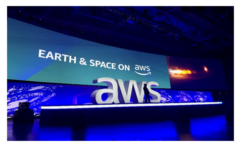
AWS hosted its first-ever Earth and Space on AWS event in Washington, DC, leading up to the AWS Public Sector Summit. Speakers from Blue Origin, NASA Jet Propulsion Laboratory (JPL), DigitalGlobe, and others spoke about the endless possibilities for the future in our solar system and beyond.

Exploring Earth and Space with the Cloud
Join us for a unique Earth & Space on AWS experience Tuesday, June 19, 2018. Hear from customers and thought leaders who are unearthing new discoveries through cloud technology and public-private partnerships. Choose from nine breakout sessions highlighting innovations with geospatial data, satellite technology, artificial intelligence, machine learning, high-performance computing, and much more.

From Sensor to Warfighter: GEOINT Post-Show Recap
The geospatial intelligence (GEOINT) community is at an inflection point – changing the way humans interact with where we are, what we’re doing, and how we understand and characterize activity on Earth. Technology greatly influences this revolution. And cloud computing will impact government’s mission. Major themes Throughout the United States Geospatial Intelligence Foundation (USGIF)’s GEOINT […]
Landsat on AWS: Half a Year, Half a Billion Requests
A few weeks ago, we had the chance to attend the world’s largest gathering of earth scientists at the American Geophysical Union’s Fall Earth Sciences Conference. More and more, research in the areas of climate change, agricultural resilience and space exploration rely on access to computing resources in the cloud. Because the cloud makes it […]