Overview
Intel Geospatial, a new venture from semiconductor chip manufacturer Intel, recently launched an open, cloud-based framework that uses artificial intelligence (AI) to visualize, analyze, and manage geospatial data collected by satellites, drones, and ground-based vehicles with sensors from Mobileye, an Intel company. Intel Geospatial’s focus is currently on electric utilities, oil and gas companies, city governments, and ecosystem service providers that lack big-data infrastructure. Using a software-as-a-service model, Intel Geospatial’s framework enables organizations to automate the inspection of infrastructure assets for maintenance issues—from damaged equipment and leaking oil tanks to missing traffic signs on busy city streets.
For a seamless user experience, the system must ingest data and then visualize, geolocate, and format it for AI-powered analytics. To help accomplish this goal, Intel Geospatial turned to Amazon Web Services (AWS) for its global presence, support, flexibility, and array of services. “There’s a growing need for cloud-based geospatial software that is user centric,” says Vijay Krishnan, general manager of Intel Geospatial. “We’re placing a big bet on the cloud and on AWS. We configured our innovative software so that users can unlock its capabilities, even if they don’t have expertise in data science or geographic information systems.”

Multipetabyte datasets are no longer uncommon. This explosion in data is driving an increasing need for compute resources and bandwidth.
Vijay Krishnan
General Manager, Intel GeospatialIntel Launches Geospatial Data Management and AI Framework Using AWS
Harnessing Multisource Geospatial Data
Digitally Transforming Businesses with Next-Generation AI
Using Visual Data to Optimize Infrastructure and Minimize Environmental Risks
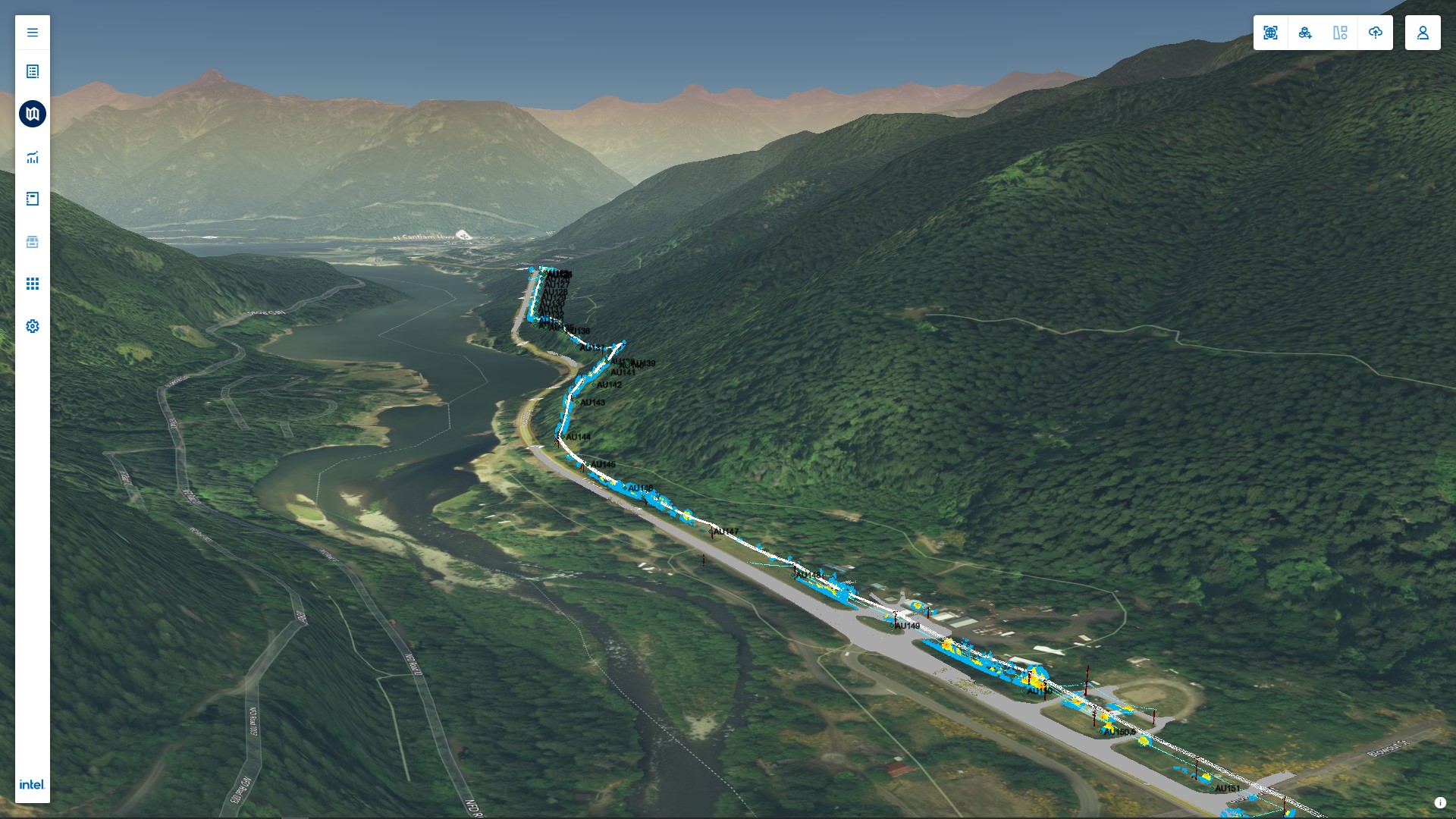
Example Intel Geospatial visualization of LiDAR data on vegetation encroachment.