AWS Public Sector Blog
Category: Satellite

How open data from weather radar helps scientists improve environmental understanding
Weather radars see more than just the weather: they see smoke from fires, meteors, birds, mayflies, and almost anything else in the atmosphere. This makes weather radars an invaluable tool for scientists seeking to further the understanding of atmospheric processes and anything else that happens to be flying through the radar’s field of view. The Amazon Sustainability Data Initiative (ASDI) seeks to accelerate sustainability-related innovation and research by helping to minimizing the cost and time required to store, acquire, and analyze large weather and climate datasets.

Scheduling satellite contact using AWS Ground Station and Python SDK
A new interactive AWS CLI tool expands the functionality of AWS Ground Station. You now have a simple way to schedule AWS Ground Station satellite contacts directly from your terminal. Learn more about how to use the CLI tool with scheduling, viewing, and canceling contacts to your satellite.

Automated Earth observation using AWS Ground Station Amazon S3 data delivery
With AWS Ground Station, you can now deliver data directly into Amazon S3 buckets. This simplifies downlinking because you no longer need to run an Amazon EC2 receiver instance. It also saves you cost and simplifies the creation of automated processing pipelines like the one we are going to show in this blog. By using an automated Earth observation (EO) pipeline, you can reduce the operating burden of your staff, as after scheduling a contact, everything is handled automatically and you’ll get a notification when the processed data is available. Read on to learn how to create an automated EO pipeline that receives and processes data from the NOAA-20 (JPSS-1) satellite, using this new AWS Ground Station feature.

Celebrating 40 years of space exploration
Space exploration has advanced significantly over the past 40 years. With missions like the space shuttle, NASA has led the way, demonstrating for the world their ability to push the boundaries of technological innovation to explore space, collect data, and enable scientific knowledge to make the world a better place. We are now in an exciting and daring new age as more organizations around the world are looking to explore space and achieve a sustainable operating presence. And fulfilling space-based missions demands innovation. Learn how AWS is supporting customers globally to push the boundaries of space exploration.

Collecting data in remote oceans with a cost-efficient, scalable, and flexible infrastructure
Saildrone builds and operates a fleet of unmanned surface vehicles (USVs) designed to collect high-resolution oceanographic and atmospheric data in remote oceans. Known as saildrones, each vehicle can stay at sea for up to 12 months, transmitting real-time data via satellite. The data collected is used to inform climate models and extreme weather prediction, maritime domain awareness, maps and charts, and sustainable management of resources. Using clean, renewable wind and solar power, saildrones provide access to the world’s oceans at a fraction of the cost of traditional ship-based methods, while drastically reducing the carbon footprint of global ocean observation.

Building cloud-based community knowledge about machine learning to predict and understand extreme weather
The National Center for Atmospheric Research (NCAR) is a federally funded research and development center sponsored by the National Science Foundation. It engages in large-scale Earth system science research projects in collaboration with the broader university community. NCAR hosts visitors from around the world, develops community models including the Community Earth System Model and the Weather Research and Forecasting Model, and maintains supercomputers, observational systems, and aircraft to support further study on the how the planet works. As part of the Amazon Sustainability Data Initiative, we invited Dr. David John Gagne, machine learning (ML) scientist at NCAR, to share how open data and machine learning on AWS are impacting the way we predict and understand extreme weather.
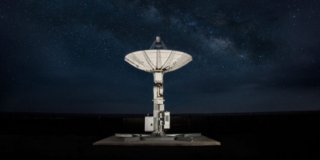
Capella uses space to bring you closer to Earth
Capella Space, a provider of on-demand Earth observation data via synthetic aperture radar (SAR), is going all-in on AWS. Capella runs its entire IT infrastructure on AWS to automate and scale its operations. AWS Ground Station makes it simple and cost effective for Capella to command and control its constellation and receive its satellite data directly into AWS using a fully managed network of antenna systems located around the world.
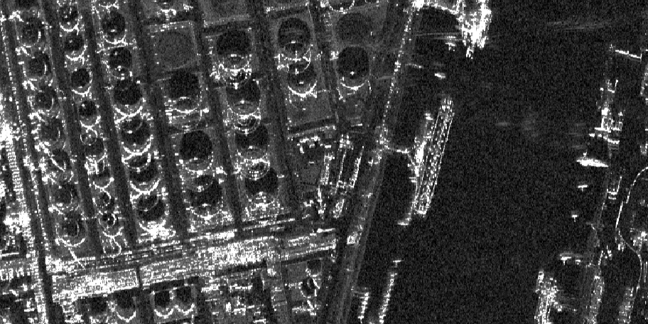
Capella and SpaceNet deliver unique views of Earth with machine learning on AWS
The breadth of challenges that can be addressed by overhead imagery is broad and continues to grow as new and improved sensors are deployed. To make the best use of this data, you need to have high-quality training data—data that you know is true (often called ground truth data) so that your algorithms can learn from it. A lack of this high-quality labeled training data continues to impede progress in many areas of remote sensing analytics, including machine learning. Two of the SpaceNet collaborators, Capella Space and AWS, are providing access to a unique dataset to help foster innovation in geospatial-based artificial intelligence. Learn more about Earth observation data, the SpaceNet 6 Challenge, and available datasets.

Mission: Exploring Earth to space
Far above the clouds, one of the fastest growing missions for the public sector is taking place. Technological advances and open data initiatives provide new paths to explore space, impacting our lives here on Earth. From satellites to rovers, cloud computing and cloud-enabled technologies help us find answers to our biggest questions.

Earth observation using AWS Ground Station: A how to guide
Over the past decade, a crop of new companies focused on Earth observation (EO) have made valuable EO data more accessible to a broad audience than before. As a result, we are seeing a dramatic increase in EO science. The value of EO data is the ability to monitor change. Recently, new instrumentation aboard satellites such as radar now allow us to “see” through clouds, allowing observation of any part of the Earth. The reliable, repeatable, and accurate data now flowing from satellites is opening up the reality of operational services powered by satellite imagery. Learn how to get started with EO data using AWS Ground Station.