Amazon SageMaker Features for Geospatial ML
Overview
Amazon SageMaker geospatial capabilities make it easier for data scientists and machine learning (ML) engineers to build, train, and deploy ML models using geospatial data. Access open-source data, processing, and visualization tools to more efficiently prepare geospatial data for ML. You can increase productivity by using purpose-built operations and pretrained ML models to speed up model building and training. Use built-in visualization tools to explore prediction outputs on an interactive map and discuss the insights and results across interdisciplinary teams.
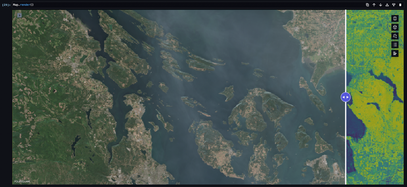
Get easier access to multiple geospatial data sources
Avoid going through multiple development cycles to import large geospatial datasets. SageMaker geospatial capabilities make it easier to access open-source imagery, such as Landsat and Sentinel-2.
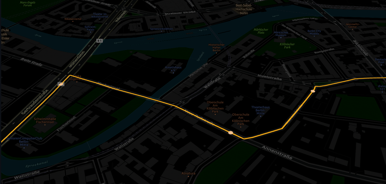
Transform your existing geospatial datasets with prebuilt operations
Save time by not needing to develop and maintain commodity code for common geospatial operations. For example, use Amazon Location Service to seamlessly reverse geocode between map coordinates—latitude and longitude—and street addresses. Use the map matching feature to automatically snap, or align, inaccurate GPS traces to known streets and roads.
Speed up preprocessing of large-scale geospatial workloads
Use off-the-shelf data preprocessing operations. Combine separate bands from different satellite images to produce a new multiband image, aggregate statistics for compute instances, and other large-scale operations on satellite data.
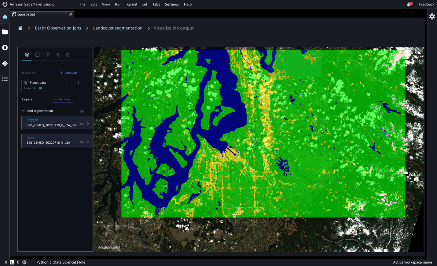
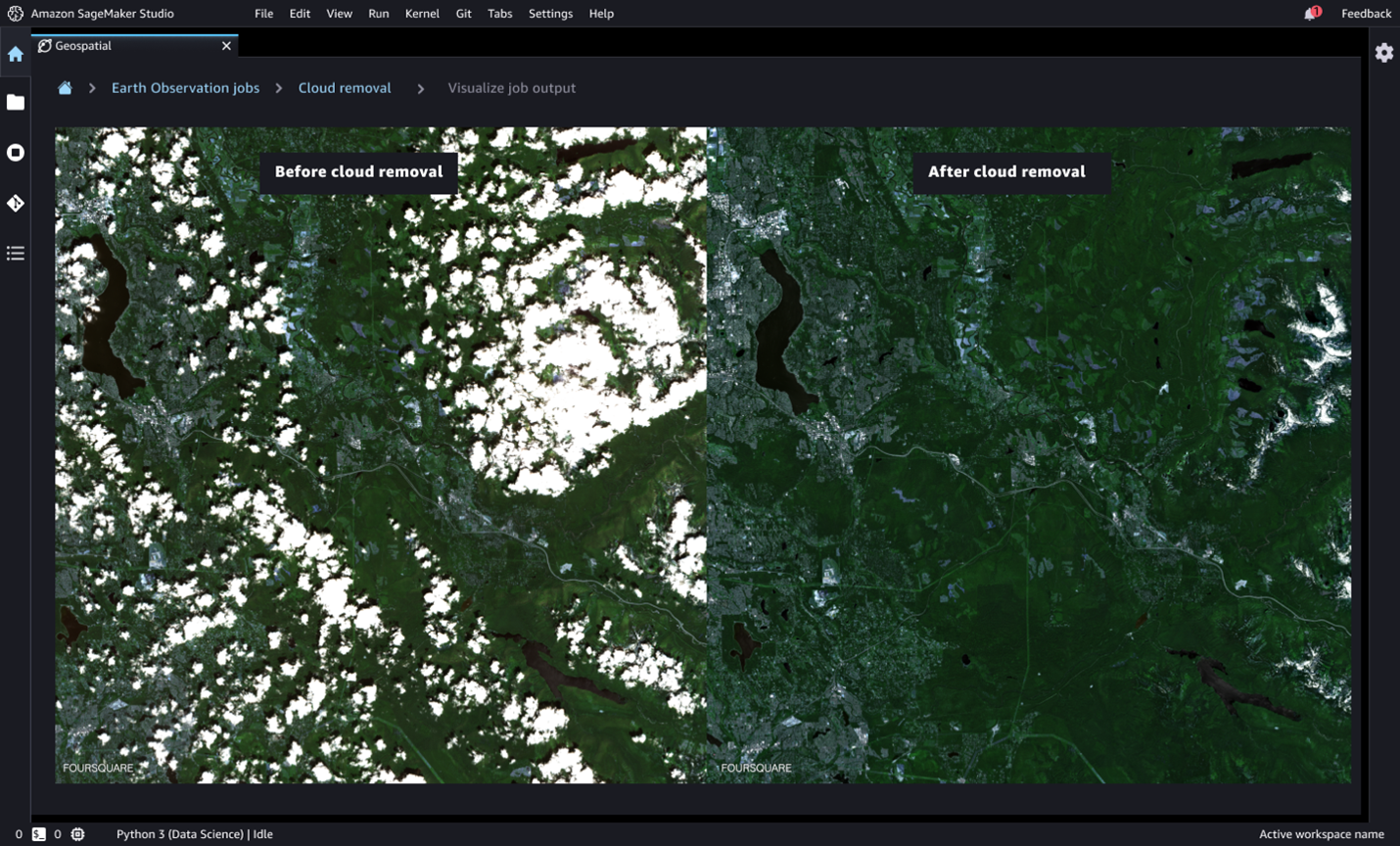
Bring your own ML model or use a prebuilt ML model to start making predictions
Use pretrained deep neural network (DNN) models such as landcover segmentation or cloud masking. For example, use landcover segmentation to identify different types of regions for landcover—including trees or water. Use cloud masking to segment cloudy and cloud-free pixels and to remove clouds and shadows using prebuilt cloud removal features.
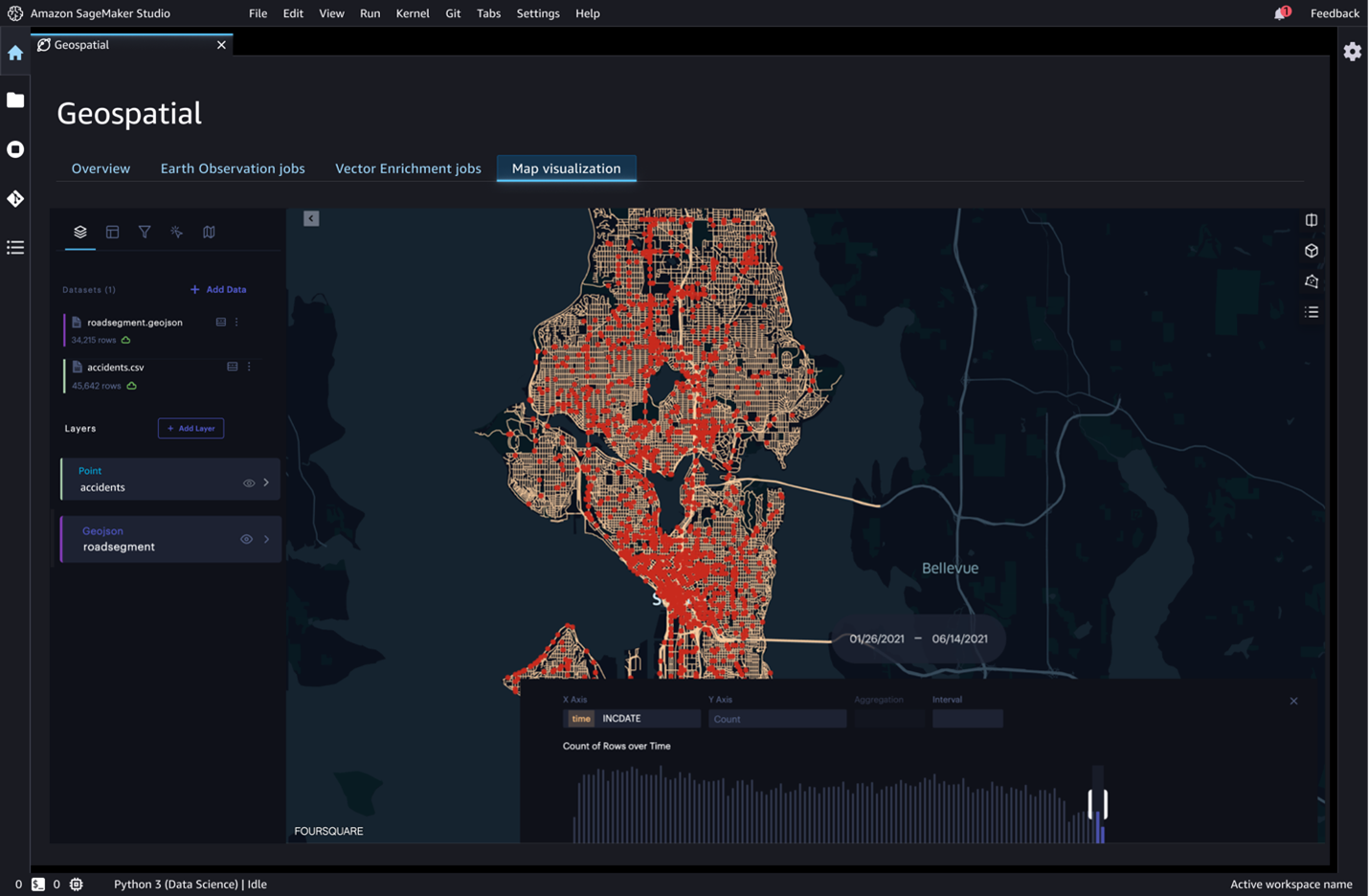
Collaborate on insights from geospatial predictions using built-in visualization tools
SageMaker geospatial capabilities help overlay model predictions on a base map and provide layered visualization to make collaboration easier. The GPU-powered interactive visualizer and Python notebooks provide a seamless way to explore millions of data points in a single window and share insights and results.