
Sold by: Esri
Esri's ArcGIS delivers mapping and spatial analysis capabilities, so telecom providers have a common understanding of their business and ultimately make informed decisions. This solution is meant for any organization who needs to map their telecom business data, organize all their authoritative location data in one place, securely share access with employees and contractors, and deliver the maps to a variety of devices such as mobile apps or web browsers.
4.5
Overview
Location intelligence is fundamental to the business of a modern telecommunications service provider.
Esri's ArcGIS delivers mapping and spatial analysis capabilities, so telecom providers have a common understanding of their business and ultimately make informed decisions. This solution is meant for any organization who needs to map their telecom business data, organize all their authoritative location data in one place, securely share access with employees and contractors, and deliver the maps to a variety of devices such as mobile apps or web browsers.
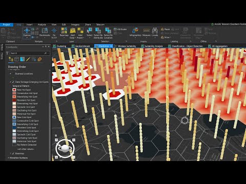
With ArcGIS, telecommunications service providers use aligned tools for all aspects of project lifecycles, from market analysis through planning, design, engineering, construction, sales/marketing, and operations. This reduces inefficiencies due to swivel-chair activities, ultimately resulting in shorter network ready-to-sell times, greater revenue, and lower costs.
FOR US DISTRIBUTION ONLY. Contact Esri directly if you are a US government, non-profit, or other customer with special pricing considerations. Outside of the United States, please contact your local Esri office for availability and pricing information.
Highlights
- Everything in the telecom business happens somewhere. ArcGIS Telecom Management uses maps and location intelligence to give your business the competitive advantage when it comes to broadband funding projects, reporting on construction status to project stakeholders, and engaging with the local community.
- ArcGIS Telecom Management puts the power of location in hands of everyone in your business. Seamlessly share maps and business information securely between the field and the office, executives and employees, and with outside stakeholders such as state broadband offices or members of the community
- The ArcGIS Telecom Management offer is a three year term commitment.
Details
Sold by
Delivery method
Deployed on AWS
New
Introducing multi-product solutions
You can now purchase comprehensive solutions tailored to use cases and industries.

Features and programs
Financing for AWS Marketplace purchases
AWS Marketplace now accepts line of credit payments through the PNC Vendor Finance program. This program is available to select AWS customers in the US, excluding NV, NC, ND, TN, & VT.

Pricing
Pricing is based on the duration and terms of your contract with the vendor. This entitles you to a specified quantity of use for the contract duration. If you choose not to renew or replace your contract before it ends, access to these entitlements will expire.
Additional AWS infrastructure costs may apply. Use the AWS Pricing Calculator to estimate your infrastructure costs.
Dimension | Description | Cost/12 months |
|---|---|---|
Small | ArcGIS System for Telecom Providers <10,000 Customers | $11,900.00 |
Medium | ArcGIS System for Telecom Providers <50,000 Customers | $30,200.00 |
Large | ArcGIS System for Telecom Providers <100,000 Customers | $60,200.00 |
Vendor refund policy
To request a refund within 30 days of your purchase, please contact marketplacehelp@esri.com and include the following: User's Name, Order Date, Order Reference ID Number, Product/Line item(s) you wish to return, and your contact information in the event an Esri representative needs to speak with you.
Custom pricing options
Request a private offer to receive a custom quote.

Legal
Vendor terms and conditions
Upon subscribing to this product, you must acknowledge and agree to the terms and conditions outlined in the vendor's End User License Agreement (EULA) .
Content disclaimer
Vendors are responsible for their product descriptions and other product content. AWS does not warrant that vendors' product descriptions or other product content are accurate, complete, reliable, current, or error-free.
Delivery details
Software as a Service (SaaS)
SaaS delivers cloud-based software applications directly to customers over the internet. You can access these applications through a subscription model. You will pay recurring monthly usage fees through your AWS bill, while AWS handles deployment and infrastructure management, ensuring scalability, reliability, and seamless integration with other AWS services.
Resources
Vendor resources
Support
Vendor support
https://support.esri.com/en/ Esri Technical Support
AWS infrastructure support
AWS Support is a one-on-one, fast-response support channel that is staffed 24x7x365 with experienced and technical support engineers. The service helps customers of all sizes and technical abilities to successfully utilize the products and features provided by Amazon Web Services.
Similar products

Mapping, location intelligence and analysis for Telecommunications

Site Scan for ArcGIS is a cloud-based drone mapping software that revolutionizes drone imagery data collection, processing, and analysis. Maintain a complete picture of your drone inventory and flight history with automatic fleet management. Securely process imagery in a scalable cloud environment to create high-quality 2D and 3D imagery products that can be quickly shared throughout your organization, on any device.


ArcGIS Enterprise is the foundational software system for GIS, powering mapping and visualization, analytics, and data management. It is the backbone for running the Esri suite of applications and your own custom applications. A base ArcGIS Enterprise deployment is the minimum setup, combining all four ArcGIS Enterprise components: ArcGIS Server powers mapping and analysis in your GIS through web services. ArcGIS Enterprise portal is the hub to create, share, and manage maps and apps. ArcGIS Data Store provides data storage for the hosting server used with your deployment. ArcGIS Web Adaptor integrates ArcGIS Server and Portal for ArcGIS with your existing web servers and your organization's security infrastructure. Systematics' offer includes a single machine deployment with the 4 components mentioned above, ready for configuration & licensing.

Gain a Competitive Edge with Location-Based Market and Community Intelligence. Get access to site analysis, business analytics, community intelligence, and demographic insights. ArcGIS Business Analyst Web App helps you make smarter market and community planning decisions using the power of location intelligence.
Customer reviews
Yogaraj S.
Easy-to-Use, Powerful Mapping and Spatial Analysis with Esri ArcGIS
Reviewed on Jul 09, 2026
Review provided by G2
What do you like best about the product?
I like that Esri ArcGIS is easy to use and has powerful tools for mapping, spatial analysis, and data management. It supports many GIS data formats, creates high-quality maps, and works well with satellite imagery and GPS data. It also has good documentation and a large user community, making it easier to learn and solve problems.
What do you dislike about the product?
One thing I dislike about Esri ArcGIS is that it can be expensive, especially for small companies or individual users. It also requires a powerful computer to run smoothly, and some advanced tools have a steep learning curve for beginners. In addition, vector processing can sometimes be slow, especially when working with large or complex datasets.
What problems is the product solving and how is that benefiting you?
Esri ArcGIS helps me organize, analyze, and visualize geographic data in one place. It makes mapping, spatial analysis, and decision-making easier and faster. This saves time, improves accuracy, and helps me complete GIS projects more efficiently.
Steven B.
Esri Has Powered My Geospatial Career for 25+ Years
Reviewed on May 01, 2026
Review provided by G2
What do you like best about the product?
I have build a career using it! over 25 years using Esri products. The geospatial industry wouldn't exist in the same way without it. Empowers me t be creating with data.
What do you dislike about the product?
Error -9999contact Esri technical support. Also it used to run much faster with ArcObjects before they went to .Net
What problems is the product solving and how is that benefiting you?
I'm a geospatial consultant so its solving my clients problems, mapping, space planning, facility management, asset inventories, indoor mapping, routing and wayfinding
Dave M.
Great Support, Needs Interface Consistency
Reviewed on Apr 28, 2026
Review provided by G2
What do you like best about the product?
I like the support they offer if I come across an issue that I can't solve. I can call them, and they get on the phone relatively quickly. They answer my question or walk me through the steps I need to get the problem solved.
What do you dislike about the product?
I do not like how the interface is different between ArcGIS Pro and ArcGIS Online. Even though the online version is a slimmer version, it should look and operate the same, and it doesn't.
What problems is the product solving and how is that benefiting you?
We use Esri ArcGIS for designing city maps to manage water and wastewater.
Dhawood Gani N.
ArcGIS: A Powerful All-in-One GIS Ecosystem with Excellent 3D and Analysis Tools
Reviewed on Apr 24, 2026
Review provided by G2
What do you like best about the product?
1. All-in-one GIS platform
ArcGIS isn’t just one tool—it’s a full ecosystem (mapping, analysis, data management, visualization, and sharing). Whether you’re working in ArcGIS Pro or publishing maps via ArcGIS Online, everything connects smoothly.
2. Powerful spatial analysis
It’s one of the strongest platforms for advanced geospatial analysis—network analysis, terrain modeling, spatial statistics, and more. This is especially useful for infrastructure, urban planning, and utilities work.
3. High-quality 3D capabilities
The 3D visualization tools (like scenes and digital twins) are impressive. If you’re doing 3D modeling—like your mall building work—it integrates well with tools such as Autodesk Revit and supports realistic rendering.
4. Data integration & scalability
ArcGIS handles huge datasets and supports many formats (CAD, BIM, satellite imagery, IoT feeds). It’s used in everything from small projects to enterprise-level systems.
5. Strong industry adoption
Because it’s widely used across government and private sectors, skills in ArcGIS are highly valuable and transferable.
6. Customization & automation
With Python (ArcPy) and ModelBuilder, you can automate workflows—very useful for repetitive tasks like QC, migration, or reporting.
What do you dislike about the product?
A common downside of Esri ArcGIS is its high licensing cost and steep learning curve—especially for beginners. Some users also find tools like ArcGIS Pro to be resource-heavy, which can slow performance on lower-end systems.
What problems is the product solving and how is that benefiting you?
Esri ArcGIS helps solve complex location-based problems by organizing, analyzing, and visualizing spatial data. It benefits me by improving accuracy, speeding up tasks like mapping and QC, and making it easier to manage large datasets and create clear, decision-ready outputs.
Danilo L.
Extremely Comprehensive Ecosystem That’s Easy and Intuitive
Reviewed on Mar 04, 2026
Review provided by G2
What do you like best about the product?
In my opinion the ecosystem is extremely comprehensive, its very easy to use and intuitive.
What do you dislike about the product?
Licensing and extensions can become expensive as the platform scales and maybe some workflows can be complex for new users.
What problems is the product solving and how is that benefiting you?
ArcGIS help us organize, analyze and visualize geospatial data efficiently. It enables better spatial decision and improve collaboration between our team.