
Sold by: CARTO
The world's leading Location Intelligence platform.
4.6
Overview
Unlock the power of spatial analysis. Data Scientists, Developers and Analysts solve spatial problems using CARTO's data and analysis to understand where and why things happen, optimize business processes, and predict future outcomes through the power of Spatial Data Science.
- Key use cases include:
- Site Selection
- Market Analysis
- Geomarketing
- Network Optimization
- Mobility Planning
- Environmental Analysis
- ... and much more (https://carto.com/solutions/ )
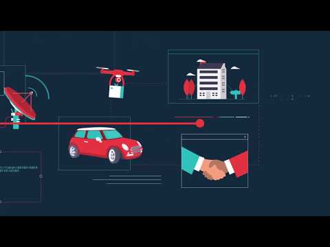
AWS and CARTO customers now have access to a powerful and versatile geospatial engine, combined with the cutting edge cloud computing services offered by AWS. In addition, CARTO can seamlessly import data from AWS Redshift, enabling data scientists to start analyzing their geospatial data quickly and efficiently.
For inquiries and pricing for our Enterprise platform through the AWS Marketplace, please contact aws-marketplace@carto.com
Highlights
- With more location data being generated than ever before, every single industry is investing in spatial analysis resources. Discover your use case today.
Details
Sold by
Delivery method
Deployed on AWS
New
Introducing multi-product solutions
You can now purchase comprehensive solutions tailored to use cases and industries.

Features and programs
Trust Center

Access real-time vendor security and compliance information through their Trust Center powered by Drata or Vanta. Review certifications and security standards before purchase.
Buyer guide
Gain valuable insights from real users who purchased this product, powered by PeerSpot.
Financing for AWS Marketplace purchases
AWS Marketplace now accepts line of credit payments through the PNC Vendor Finance program. This program is available to select AWS customers in the US, excluding NV, NC, ND, TN, & VT.

Pricing
Pricing is based on the duration and terms of your contract with the vendor. This entitles you to a specified quantity of use for the contract duration. If you choose not to renew or replace your contract before it ends, access to these entitlements will expire.
Additional AWS infrastructure costs may apply. Use the AWS Pricing Calculator to estimate your infrastructure costs.
Dimension | Cost/12 months |
|---|---|
Carto Enterprise Large | $89,000.00 |
Vendor refund policy
No refunds except when required by law.

Legal
Vendor terms and conditions
Upon subscribing to this product, you must acknowledge and agree to the terms and conditions outlined in the vendor's End User License Agreement (EULA) .
Content disclaimer
Vendors are responsible for their product descriptions and other product content. AWS does not warrant that vendors' product descriptions or other product content are accurate, complete, reliable, current, or error-free.
Delivery details
Software as a Service (SaaS)
SaaS delivers cloud-based software applications directly to customers over the internet. You can access these applications through a subscription model. You will pay recurring monthly usage fees through your AWS bill, while AWS handles deployment and infrastructure management, ensuring scalability, reliability, and seamless integration with other AWS services.
Resources
Vendor resources
Support
AWS infrastructure support
AWS Support is a one-on-one, fast-response support channel that is staffed 24x7x365 with experienced and technical support engineers. The service helps customers of all sizes and technical abilities to successfully utilize the products and features provided by Amazon Web Services.
Updated weekly
By CARTO


By Mapbox
Sentiment is AI generated from actual customer reviews on AWS and G2
Functionality
Ease of use
Customer service
Cost effectiveness
Positive reviews
Mixed reviews
Negative reviews
AI generated from product descriptions
Spatial Data Analysis Engine
Geospatial engine enabling spatial analysis and data science capabilities for understanding spatial relationships and patterns
Cloud Data Integration
Seamless integration with AWS Redshift for importing and analyzing geospatial data within cloud computing infrastructure
Location Intelligence Platform
Comprehensive platform for analyzing location-based data to optimize business processes and predict outcomes
Multi-Domain Spatial Analysis
Support for diverse spatial analysis applications including site selection, market analysis, network optimization, and environmental analysis
Data Science and Analytics Tools
Tools and capabilities for data scientists, developers, and analysts to perform spatial problem-solving and geospatial data exploration
Spatial Database Functions
WherobotsDB provides 300+ accelerated spatial functions covering vector geometry and raster processing with native Spark SQL support for tabular operations, based on Apache Sedona.
Planetary Scale Computer Vision Inference
RasterFlow ingests satellite and aerial imagery, builds inference-ready mosaics, runs computer vision models at scale, and delivers structured spatial features to downstream applications.
Spatial AI Development Environment
Spatial AI Coding Assistant connects AI coding environments to spatial datasets via VS Code and MCP, enabling natural language queries, dataset discovery, and job execution against physical-world data.
Serverless Spatial Processing
Serverless architecture enabling spatial workloads to execute without cluster management or capacity planning, with pay-as-you-go resource consumption model.
Built-in Spatial Analytics
Out-of-the-box capabilities including map matching, geostatistics, map tiling, and GeoAI functions for spatial analysis and processing.
Vector and Raster Tile Rendering
Supports Vector Tiles, Raster Tiles, Static Images, and Static Tiles for map rendering across web and mobile applications.
Multi-Modal Routing and Navigation
Provides walking, cycling, driving, and electric vehicle route calculation with turn-by-turn navigation capabilities for mobile applications.
Geocoding and Address Services
Offers forward and reverse geocoding, batch geocoding, address autofill, address verification, and search box functionality for addresses and points of interest.
Route Optimization and Travel Analysis
Includes vehicle pickup and delivery logistics optimization, isochrone travel time polygon generation, and matrix routing to calculate travel times between multiple points.
Real-Time Location Data Integration
Ingests 2.1 billion miles of anonymized mobility data weekly from 45,000+ mobile applications and vehicle sensors, combined with 150+ commercial, government, and open data sources.
Standard contract
No
No
No
Customer reviews
reviewer2870538
Versatile ablation mapping has supported complex atrial arrhythmia treatments and guides redo cases
Reviewed on Jul 10, 2026
Review provided by PeerSpot
What is our primary use case?
My main use case for CARTO is typically for atrial fibrillation, radiofrequency ablations for atrial fibrillation, atrial flutter, and atrial tachycardia. Basically, all of those aside from the PFAs, of course.
What is most valuable?
What stands out to me most about CARTO is its versatility because nowadays we are performing more pulsed-field ablations, but those are limited to atrial fibrillation. If you have to do CTI lines or you have to do atrial flutter or atrial tachycardia on top of your atrial fibrillation, it is much better to use CARTO from the very beginning, especially if the patient has a redo ablation. Because if you are doing a redo ablation, you can actually find problems that may arise while you are ablating the patient. From my experience with our professors from Brompton and Harefield Hospital, for example, this professor who has been trained internationally would even consider ablation with absolute alcohol. To that extent, we can go to the Vein of Marshall, and if CARTO ablation fails with radiofrequency ablation, then we can consider absolute alcohol ablation with CARTO. You cannot do that with Cryo, nor with PFA as well, so that is what stands out for me.
CARTO's versatility helps me handle complex or redo ablations because I have more options in terms of conjunction with other catheters, especially for electrophysiology studies at the beginning. You can plan your ablations or radiofrequency ablations before the procedure, but when you are there, it is much easier and much faster to make or change the decision than the ones that you planned ahead of time. If something arises, for example, ventricular ectopics, and then a random arrhythmia develops, then I would rather have CARTO system on my side rather than another system.
CARTO has positively impacted my organization because I think sixty percent of our cardiology procedures are mostly ablations, and we work closely with different groups of doctors. Mainly, it is cardiology doctors who have been researching and have patients that have aberrant anatomies in terms of finding arrhythmias, for example, the anatomy of the heart being completely flipped or opposite. Their research is more based on CARTO ablation treatments rather than the newer ones or cryoablations. Evidence-based, CARTO ablations are much better at the moment and have more evidence-based backup in terms of treatment.
What needs improvement?
Regarding improvements for CARTO, I think the main pain points are because newer technologies, such as pulsed-field ablation, have taken over angiography departments and cath labs by storm since last year. There are many different PFA catheters that have had shorter duration for AF ablation treatment. I think it is feasible for CARTO representatives and CARTO managers to actually do case studies or presentations of case studies, not just to physiologists, but also for the healthcare professionals and alliance inside the labs. In reality, it is not just the doctor who decides what happens to that patient; sometimes they ask the team what should have been done better in the debriefing. If you educate nurses in terms of case studies or if you educate radiographers, not just the physiologists, then they would certainly suggest that if you use CARTO ablation, you will have these options and different types of treatments in conjunction with your CARTO ablations, which are not limited to just the cardioversion secondary to your PFA ablations. That is where it starts: education and training, sponsoring HCPs to actually know CARTO ablations more rather than just the PFA because at the end of the day, that still wins in my opinion. Again, it is the versatility of CARTO ablation system, so focus on that.
Regarding improvements needed with the catheter, I would say it is more of the tip of the catheter. Of course, your special metals that you use for the tip of your catheters can be recycled, but it is more of the whole body of the catheter for sustainability in the future. We collect our cables for CARTO ablations and then recycle them because there is a company who does that for us. The special metals we usually send as well to be recycled, but the whole body of your catheter is not really sustainable; it is per protocol. Hopefully, in the future, someone will create a material that can actually be recycled and not just be placed in the bin, adding pollution or waste management.
I chose eight out of ten for CARTO because it would make it a ten for me if the treatment duration can compete with the time duration of PFA. Our department's current business model earns more if the duration of procedures is shorter, allowing us to do more patients in a list. If we do CARTO ablation, we are limited to two to three patients in one doctor's list because we reserve their slot and they have their protected slot. However, with PFAs, you can do five to six patients in a list. The more patients you can do in a shorter time with an efficient treatment that is not far from the treatment of CARTO ablation at the very outcome of it, then it is much better.
Regarding CARTO's AI capabilities, I think education and training are vital for healthcare professionals in the labs. It is much better for us to hear updates directly from you about CARTO ablations. That way, we can relay our experiences in terms of the AI side.
I believe there are no other improvements needed for CARTO that we have not discussed yet, but if you mention AI and talk about the accuracy, would it not be better for people not to use AI entirely and rather make it just a tool than depend on AI. I know many software applications have been implemented and deployed recently with AI features, but to a certain extent, I see AI as a tool to improve work. At the end of the day, the representatives who help the doctor decide where to locate the arrhythmia and where to ablate are the ones that truly count and matter. If AI is just gathering information in general but not actually reflecting our experiences in the labs directly, that is where the concern lies.
For how long have I used the solution?
I have been using CARTO since St George's day, which was 2019 to present.
What other advice do I have?
My advice to others looking into using CARTO is to optimize treatments involved in CARTO ablations. Other doctors are still not as experienced as our professors in the labs, and I think there is more that can be done in conjunction with atrial fibrillation treatment. For instance, there is only one professor using alcohol ablation at the end of CARTO ablations when he is determined to actually ablate the patient. None of his patients actually fail ablating AFs because we have to be transparent at the end of the day. There are cases who have had ablations that were not successful at all, leading patients to pursue a different pathway, which is frustrating and disappointing to see them experience. I rated CARTO eight out of ten based on my experience and the considerations I have outlined.
reviewer2867418
Interactive mapping has transformed how I visualize population patterns and explore spatial data
Reviewed on Jul 01, 2026
Review provided by PeerSpot
What is our primary use case?
In my project, I used CARTO to create a choropleth map showing population density by administrative area. I imported a CSV file with demographic data, joined it with geographic boundaries, and used CARTO's styling option to visualize the difference across regions. I also experimented with spatial filtering and basic aggregation to explore patterns in the data. It was a good way to understand how CARTO handles data visualization and spatial analysis.
My main use case was exploring CARTO for spatial data visualization and basic geophysical analysis.
What is most valuable?
From my experience, the best feature for CARTO is how easy it is to create interactive maps. I could import data, customize the map styling, and visualize spatial patterns without needing a lot of coding. I also found the built-in spatial analysis tools useful for simple tasks such as filtering, aggregating, and identifying geographic patterns. Another feature I appreciated was its clean interface, which made it relatively easy to learn and navigate as a new user.
One feature I found especially helpful was the filtering and aggregation tools. After importing my dataset, I filtered the data to focus on a specific region and then aggregated the results by administrative boundaries to make the map easier to interpret. It helped me identify patterns without having to write complex queries. I also appreciated the map customization option. I could easily change the color scheme, adjust the classification method, and customize the pop-ups to display relevant information. Those features made the map much more intuitive and visually appealing, especially when presenting the results.
Since I used CARTO mainly for a personal learning project rather than within an organization, I cannot really speak to its impact on organizational workflow. However, from my experience, it made the process of visualizing spatial data much faster and more organized. Creating an interactive map and sharing insights was straightforward, which I can see being valuable for collaboration and decision-making in a team environment.
What needs improvement?
I had a positive experience with CARTO, but I think there are a few areas where it could be improved. As a new user, I found that some of the more advanced geospatial analysis features have a bit of a learning curve. More step-by-step tutorials and in-app guidance would make it easier for beginners to get started. I also think the interface could make some advanced settings easier to find, since I occasionally had to spend time looking through the documentation. Other than that, I found the platform intuitive and capable for creating maps and exploring spatial data. CARTO is the best tool for the visualization of data.
An additional area for improvement is performance when working with large datasets. I mostly worked with small datasets, so I did not run into major issues myself, but I think optimizing performance for larger projects would be beneficial. I also think expanding integrations and making the setup process even more seamless for different data sources could improve the overall experience. Finally, having more built-in templates or guided workflows for common geospatial analysis tasks would help new users become productive more quickly.
For how long have I used the solution?
I have been using CARTO for a short period as part of my project.
What do I think about the scalability of the solution?
My experience was limited to small-scale projects, so I did not have the opportunity to test CARTO's capability with large datasets or enterprise workloads. For the projects I worked on, it handled everything smoothly, and the performance was consistent. Based on what I saw, it appears capable of supporting larger use cases, but I do not have enough hands-on experience to evaluate its scalability beyond my own project.
How are customer service and support?
The documentation was clear enough for the basic tasks I was working on, such as importing data, creating maps, and exploring the platform. Because of that, I did not need to contact customer support.
How was the initial setup?
From a user perspective, I found it straightforward to get started. The account setup and onboarding process were simple, so I was able to start importing data and building maps fairly quickly.
What was our ROI?
Since I used CARTO for a personal learning project rather than in a business environment, I cannot really measure ROI in terms of money saved or reduced staffing. The main benefit I noticed was time savings. Compared to creating maps manually, I estimate it saved me about one to two hours on a small project because importing data, styling maps, and generating visualizations was much more efficient.
Which other solutions did I evaluate?
I did not conduct an informal evaluation process since this was a learning project. I chose CARTO because it was well-known for geospatial visualization and easy to get started with. I was aware of other GIS tools such as QGIS and ArcGIS, but I did not conduct a detailed features-by-features comparison before using CARTO.
What other advice do I have?
I found CARTO to be user-friendly, especially for creating interactive maps and performing basic spatial analysis. One thing I also appreciated was how quickly I could go from importing data to producing a visualization, which made the learning process smooth. Those were the features that stood out the most to me.
I do not have a precise figure because I was not tracking my time, but I estimate it saved me about an hour on a small project. Most of the time savings came from how quickly I could import data, customize the map, and generate visualizations compared with doing those steps manually.
My advice would be to start with a small project so you can become familiar with the platform before moving on to more advanced workflows. Take advantage of the documentation and tutorials, since they make the learning process much easier. I also recommend spending some time understanding your data before importing it because having well-organized data makes it much easier to create meaningful visualizations and perform spatial analysis. Overall, I think CARTO is a good option for anyone looking to create interactive maps and explore geospatial data without a complicated setup.
I had a positive experience with CARTO. Even though I used it mainly for a learning project, I found it intuitive and easy to get started with. It made creating interactive maps and exploring spatial data much more accessible. I think it has a lot of potential for more advanced use cases, and I would be interested in exploring more of its features in the future. I gave CARTO a rating of eight out of ten.
Layyub Ayub
Beat‑by‑beat mapping has improved PVC ablations and supports accurate, efficient procedures
Reviewed on Jun 09, 2026
Review provided by PeerSpot
What is our primary use case?
My main use case for CARTO includes SVTs and PVCs, specifically for ablations. We use CARTO to map arrhythmias within the heart during ablations.
What is most valuable?
It is especially helpful for finding PVCs with CARTO because you can match by percentages.
One of the best features CARTO offers is the ability to match rhythms beat-by-beat, allowing us to pinpoint the exact location of the arrhythmia that we want to ablate.
The beat-by-beat matching with CARTO works well for us in practice, and it both saves time and improves accuracy.
I really appreciate the people involved, which adds to my overall experience with the features of CARTO.
CARTO has positively impacted my organization because the people that you hire are really nice to work with, and that makes all the difference.
Working with the CARTO team has made a positive impact because they are helpful with setting the room up and tearing it down, and they are always really personable and down to earth.
What needs improvement?
It would be beneficial if the patches of CARTO were not as susceptible to breakage, as the connections get broken frequently when we put them on the patient and take them off.
For how long have I used the solution?
I have been using CARTO for about eight years.
What do I think about the stability of the solution?
CARTO is stable.
What do I think about the scalability of the solution?
CARTO could grow even more using PFA technologies regarding its scalability.
How are customer service and support?
The customer support for CARTO is great. I would rate the customer support for CARTO as a 10 on a scale of one to 10.
Which solution did I use previously and why did I switch?
I have not previously used a different solution; I have worked with CARTO throughout my entire career.
Which other solutions did I evaluate?
I did not evaluate other options before choosing CARTO; those were assigned to each case based on what the doctor decided.
What other advice do I have?
My advice to others looking into using CARTO is to not be afraid to ask questions. I would rate this review a 10 overall.
NDJEL Dan
Geospatial workflows have become faster and collaboration improves plantation monitoring
Reviewed on May 27, 2026
Review provided by PeerSpot
What is our primary use case?
My main use case for CARTO includes plantation monitoring, EUDR compliance, mapping, and deforestation analysis.
What is most valuable?
CARTO is really useful, and I appreciate the detailed example shared. The best features CARTO offers include the ability to handle raster and vector data together, which is important for my work because it helps me compare efficiently with other tools I have tried.
CARTO has positively impacted my organization by helping me save time, and I can share more about how much time I save and how my workflow is faster with CARTO, including specific outcomes or metrics. CARTO has also helped my team collaborate better and share data more easily.
What needs improvement?
I would like to add more about the needed improvements for CARTO, possibly something else that would make my experience even better.
Regarding CARTO's AI capabilities, I trust it, but not at one hundred percent because I do not know all the third parties around the data, and I wish to know more about it.
For how long have I used the solution?
I have been using CARTO for almost six months.
What do I think about the stability of the solution?
I find CARTO stable.
What do I think about the scalability of the solution?
I would rate CARTO's scalability as good.
How are customer service and support?
The customer support I have received from CARTO is good; it is not bad.
Which solution did I use previously and why did I switch?
Before CARTO, I previously used Google Earth Engine, but I switched because Google Earth Engine does not take into account every parameter, and CARTO is more comprehensive.
How was the initial setup?
My experience with pricing, setup cost, and licensing is that it is a little bit expensive.
What was our ROI?
I have seen a return on investment with CARTO, as I have saved time, money, and resources, including human resources since using it.
Which other solutions did I evaluate?
Before choosing CARTO, I did not evaluate other options.
What other advice do I have?
The language is a challenge; Cameroon is a bilingual country, but there are not more than five people who master English in my organization. Most of my colleagues are French speakers, so the interface should be available in both English and French for easy transition and smooth working.
I faced challenges when trying to import some data from my personal computer, but besides that, CARTO integration is smooth with other tools or systems I use.
I would describe the learning curve for new users on my team as moderate.
I have not used CARTO's mobile features or apps.
My advice for others looking into using CARTO is to have a quick review of the basics in GIS mapping. CARTO does provide the basics, but without basic skills, navigating it can be quite challenging, so having some experience with traditional GIS software is valuable.
I found this interview a bit too fast at times; you do not listen. I would rate this interview at a nine point five out of ten.
Sarah Syala
Advanced mapping has enabled safe, fast complex ablations and significantly reduced fluoroscopy use
Reviewed on May 26, 2026
Review provided by PeerSpot
What is our primary use case?
I work in a government hospital in Baghdad, Iraq. My main use case for CARTO is that I work on all cases, from AVNRT to VT, and I have performed all cases, including atrial fibrillation on CARTO and VT.
What is most valuable?
The best features of CARTO that I use most during my procedures are pattern matching, voltage mapping, substrate mapping, and anatomical mapping when I take points.
CARTO has impacted my lab overall by allowing for short procedure times. I do not use fluoroscopy, which is very important. It results in short procedure times, no use of fluoroscopy, and successful outcomes in all cases with CARTO.
What needs improvement?
There are features in CARTO that I do not use very much, such as the Ablation Index, which is very important for AF ablation. Additionally, when I take all ECG references in VT, I think the option is called all ECG reference, which is very important when I have taken it in VT. I think the feature of histogram is very important in re-entry mapping.
For how long have I used the solution?
I have been using both CARTO and EnSite X for more than five years in daily EP practice, and from real-world experience, CARTO is not just a 3D mapping system.
What do I think about the stability of the solution?
I value CARTO because it is more than stable, and I can perform all cases, including difficult cases, with CARTO because it is stable and easy to use.
Which solution did I use previously and why did I switch?
Before I started using CARTO, the system I was using in the lab was fluoroscopy, but we also had the conventional system. CARTO does not have a conventional or EP study system.
How was the initial setup?
When I start a procedure and open CARTO, I connect all catheters in the PIU and start to form the geometry. Before that, I prepare the window of interest for the case. For VT, I will take a QRS template and perform pattern matching.
What about the implementation team?
When I use CARTO during procedures, it is just the doctor and I operating the system. There is no need for anyone else because CARTO will do everything. Fluoroscopy is not needed when you use CARTO.
Which other solutions did I evaluate?
When my lab was choosing CARTO, CARTO was the only option and we did not consider any other mapping systems.
What other advice do I have?
I hope to have more training, but I think I am performing well currently. I would rate this review as highly positive based on my experience with CARTO.