Amazon Location Service
Easily and securely add location data and mapping functionalities to applications
What is Amazon Location Service?
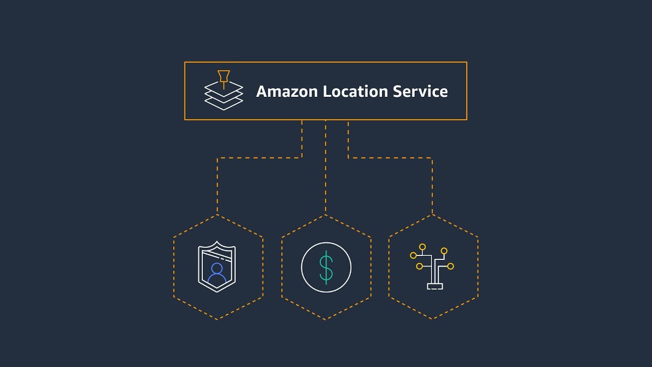
Amazon Location Service is a mapping service that allows you to add geospatial data and location functionality to applications, including dynamic and static maps, places search and geocodes, route planning, and device tracking and geofencing capabilities. With Amazon Location Service, you can safeguard customer data, reduce cost, and easily integrate with other AWS services. Get started with Amazon Location Service with AWS Free Tier
Everything you need to build mapping applications
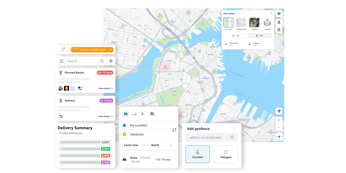
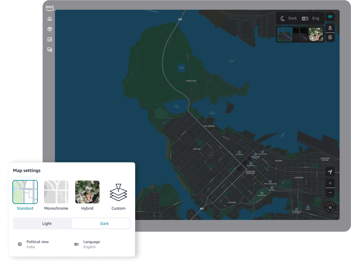
Create captivating maps
Build digital maps that showcase your locations, visualize your data, and unlock insights to drive your business. Embed maps with detailed roads, points of interest, and satellite imagery to provide an immersive experience for your users. Easily overlay your own data to identify patterns, make informed decisions, and create rich, interactive experiences.
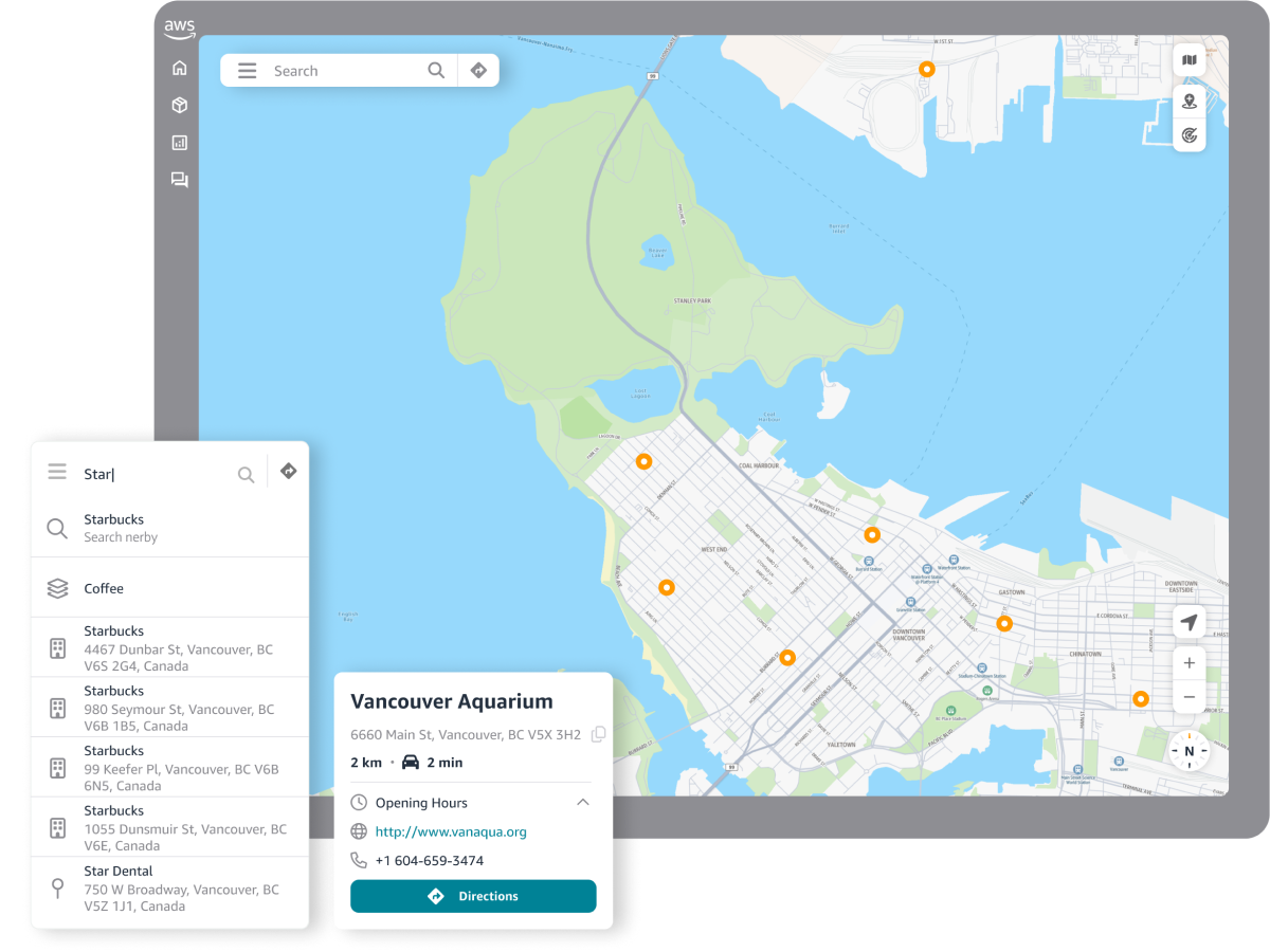
Elevate your applications with places search
Quickly search, display, and filter places, businesses, and locations based on proximity, category, and name. Streamline address entry with autocomplete to boost productivity and data integrity. Empower users to find what they need, faster, with dynamic search functionality. Integrate location-based features like POI, geocoding, and reverse geocoding to provide personalized user experiences.
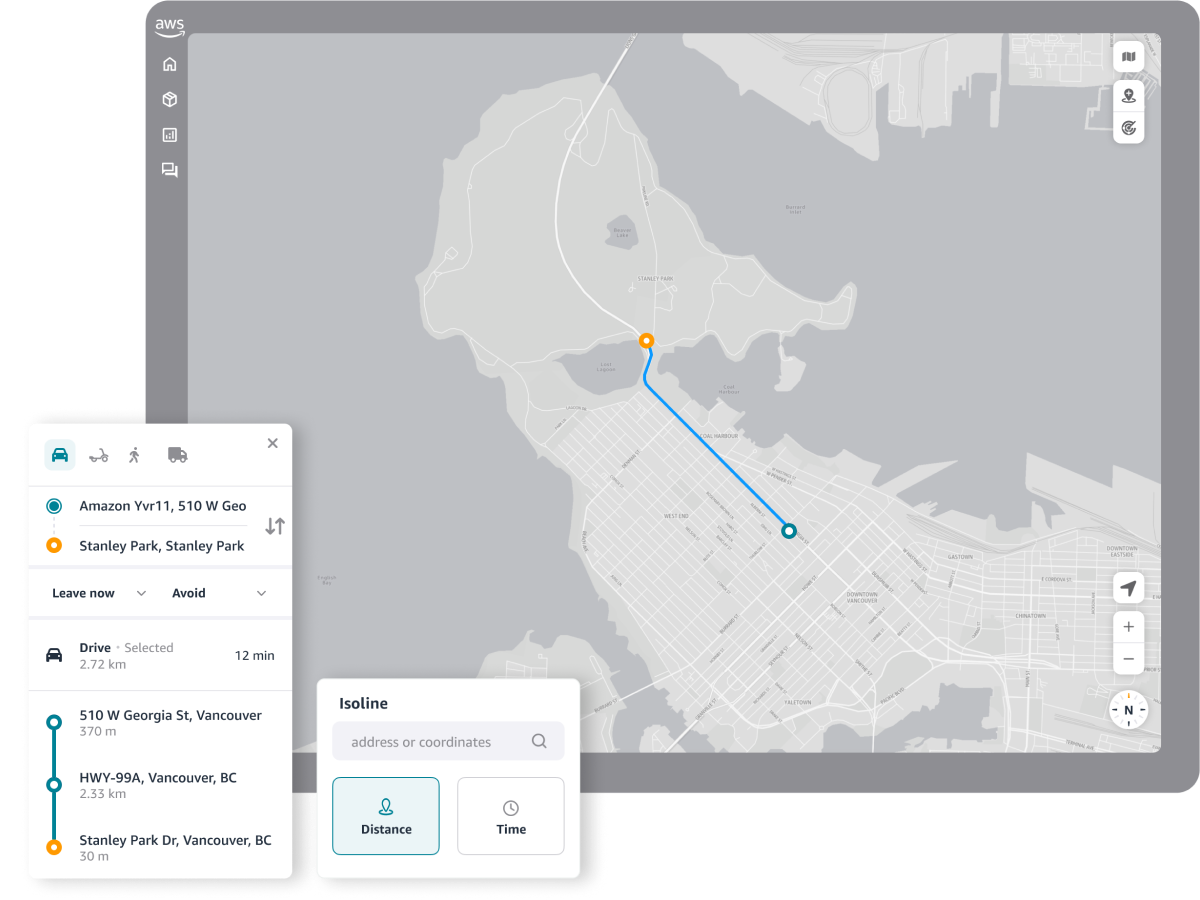
Optimize routes, maximize productivity
Leverage real-time traffic, vehicle restrictions, and turn-by-turn directions to plan efficient routes, streamline deliveries, and reduce costs. Calculate routes specific to truck restrictions, make sure you make your stops in the optimal order, and visualizes the GPS traces of your traveling vehicles. Calculate optimal routes between multiple start and end locations and make smarter decisions by visualizing your serviceable area.
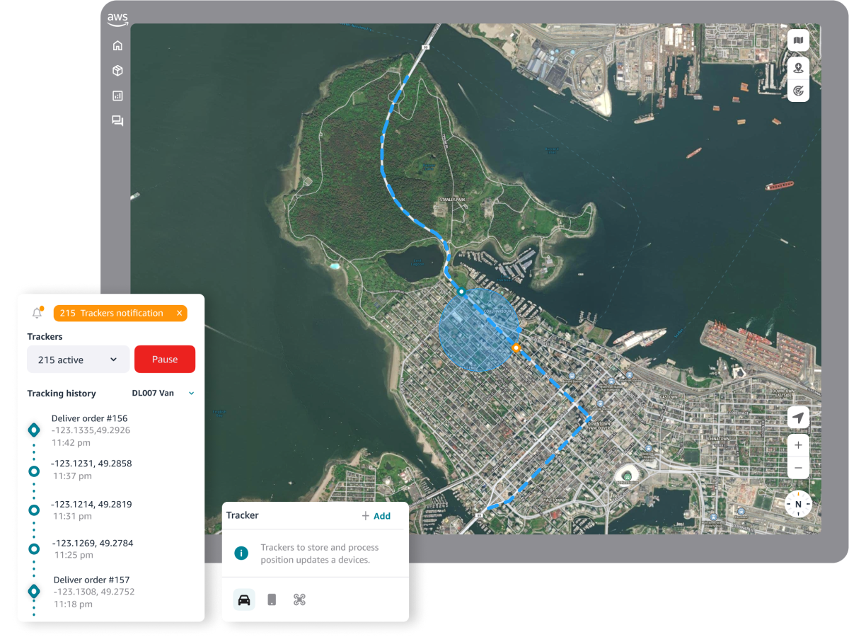
Track your asset in real-time
Enable real-time tracking and monitoring of assets to achieve end to end visibility into your business operations and resources. Turn data into actionable insights to improve asset utilization, streamline productivity and optimize operational efficiency.
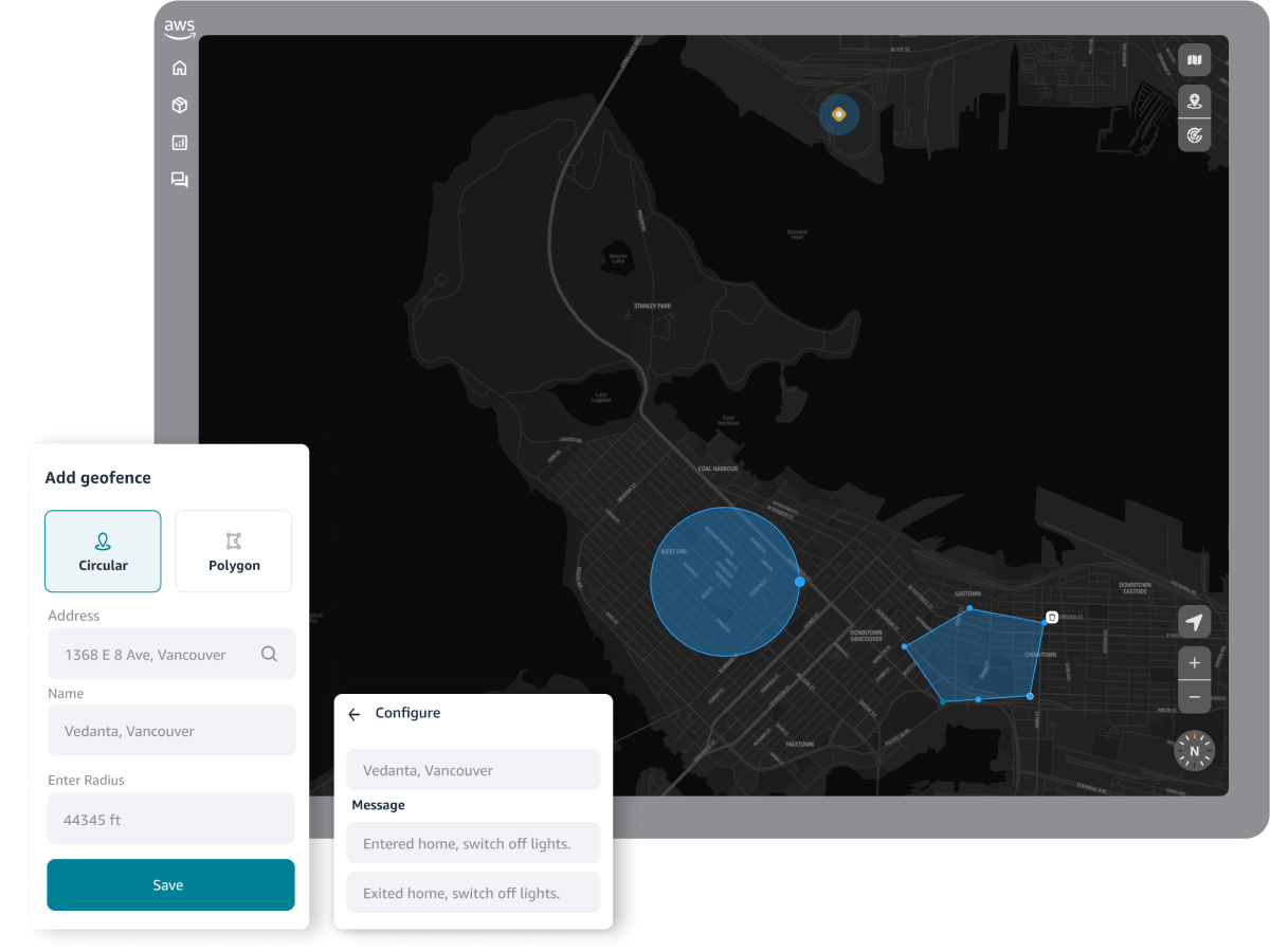
Unlock the power of location-based monitoring
Leverage location-based monitoring to automatically trigger alerts, empowering you to respond to events and reduce risks. Know when vehicles or people leave restricted areas. Filter for relevant activity to streamline cost management and optimize operations. Unlock end-to-end visibility and turn data into actionable insights that improve asset utilization and productivity.
Key benefits
Data points
Use cases
Ensure address data is consistently formatted. Correct any spelling and abbreviation errors, and eliminate duplicates in data sets. Know where your customers are to correctly inform resource planning, marketing campaigns, and successful deliveries.
Determine the best delivery route between origins and destinations using travel time, distance, road characteristics, and real-time traffic, to reduce transportation costs and improve on-time deliveries.
Build maps into your applications to create location-based experiences. Visualize business locations, search for points of interest, and help users find specific addresses. Enable seamless location sharing and geotagging features to engage your customers.
Increase transparency and traceability of property, people, and supply chain resources in order to optimize utilization, improve data-driven decisions, and mitigate cost-driving risks.
Customers optimizing their operation and productivity with Amazon Location Service