AWS Physical AI Blog
Category: Industries
Atinary’s AI & Self-Driving Labs® on AWS accelerate R&D for Takeda and MIT
Self-Driving Labs® are no longer a vision Developing a new drug takes an average of 10-15 years and costs over $2 billion. For patients waiting on life-saving treatments, every month of R&D delay matters. The bottleneck isn’t a lack of scientific talent, it’s the sheer scale of experimentation required. A single drug optimization campaign might […]
Physical AI in Healthcare: Redefining Care Delivery at the Edge
From Hospital Walls to the Home — A New Era of Intelligent Care Healthcare has long been defined by a fundamental constraint: the best care requires physical presence — patients travel to hospitals, clinicians are bound to facilities, and monitoring depends on proximity. But what if AWS-powered intelligence could follow the patient — anywhere, anytime? That is […]
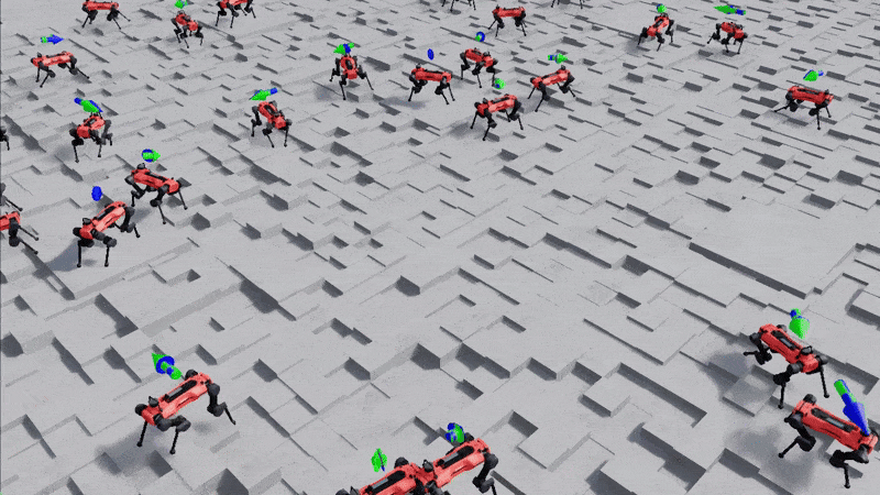
GPU-Accelerated Robotic Simulation Training with NVIDIA Isaac Lab in VAMS
The open-source Visual Asset Management System (VAMS) now supports GPU-accelerated reinforcement learning (RL) for robotic assets through integration with NVIDIA Isaac Lab. This pipeline enables teams to train and evaluate RL policies directly from their asset management workflow, leveraging AWS Batch for scalable GPU compute. Isaac Lab for Physical AI and Robotics Development Figure 1: […]
Empowering Sustainable Agriculture with AI-Powered Leaf Nutrient Sensing on AWS
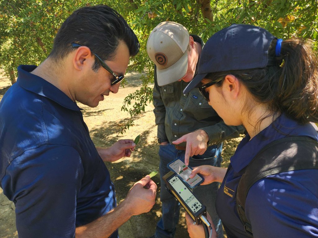
The Challenge of Nutrient Management in Agriculture For decades, fertilizers have been essential to producing healthy crops and maintaining yield. Yet in many orchards today, especially those growing pistachios, grapes, and almonds across California, the benefits of extra fertilizer are beginning to level off. Growers often apply more nutrients than the plants actually need because […]

From 2D to 3D: Building a Scalable Human Mesh Recovery Pipeline with Amazon SageMaker AI
In the ever-evolving landscape of computer graphics and animation, the ability to automatically generate realistic 3D human animations from video data could transform how digital content is created. From immersive fitness experiences to cutting-edge movie productions, the demand for accurate and lifelike digital human representations has never been more important. However, the process of converting real-world […]
Building Production-Ready 3D Pipelines with AWS Visual Asset Management System (VAMS) and 4D Pipeline
Discover how AWS Visual Asset Management System (VAMS) orchestrates 3D assets from design tools to customer channels, with a proof of concept demonstrating automated pipeline processing and real-world implementation. Overview AWS Visual Asset Management System (VAMS) functions as both a Digital Asset Management (DAM) system and a 3D-aware orchestration layer. VAMS can act as the […]

A Maturity Level Framework for Industrial Inspection Report Automation
Introduction Vision systems are increasingly being deployed for industrial inspection. Mounted on drones, ground robots, or integrated into fixed and portable monitoring cameras, these systems capture massive volumes of 2D and 3D data that must be processed to yield actionable insights. Advances in computer vision—enhanced more recently by AI and agentic AI—are transforming what was […]
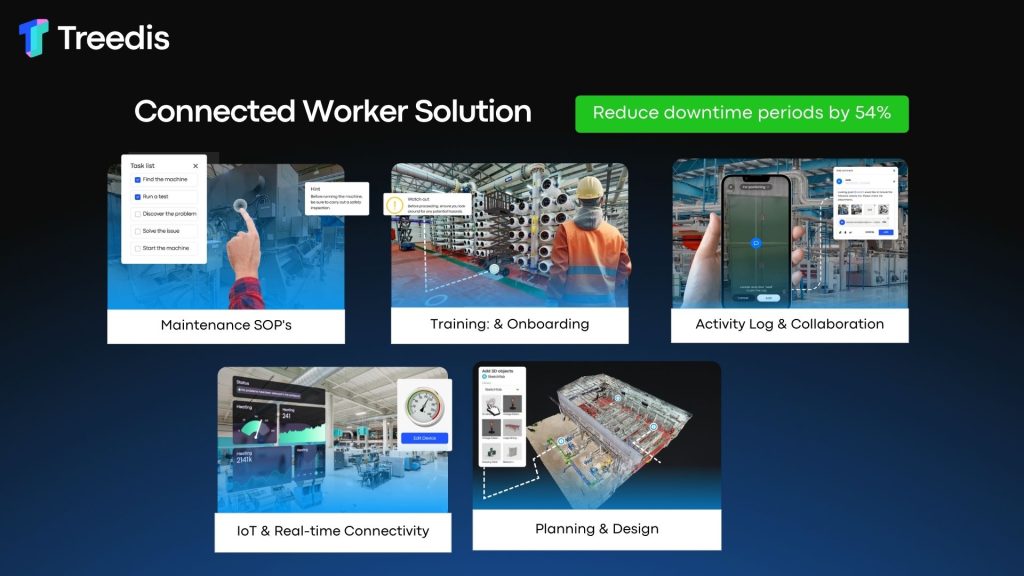
Partner Spotlight: How Treedis Powers the Connected Worker with a Spatially Aware Digital Twin on AWS
Introduction The factory of the future isn’t built on machinery alone; it’s built on a connected, empowered workforce. Treedis helps you build that future with our Connected Worker product – a no-code solution built on AWS that uses the power of the digital twin to overcome modern industrial challenges. Image showing Connected Worker Solution and […]
Spatial Computing Podcast Launch Announcement
Introducing “The 3D Podcast: Spatial Computing on AWS” – Where Immersive Technology Meets Cloud Innovation We’re thrilled to announce the launch of “The 3D Podcast: Spatial Computing on AWS,” a new show dedicated to exploring the cutting-edge intersection of spatial computing and cloud technology. In an era where digital experiences are becoming increasingly immersive and […]
From Local to Global: Scaling 3D Pipelines with AWS and RapidPipeline
At DGG, our mission has always been to help enterprises scale their 3D data workflows, fast, reliably, and at production scale. With the upcoming launch of our new RapidPipeline plugins at SIGGRAPH 2025, we’re opening the door to seamless integration with the tools 3D professionals already use, and setting the stage for scalable, cloud-first workflows […]