AWS Public Sector Blog
Geospatial Platform: Shared and Trusted Geospatial Data for Government Agencies
In May 2015, the CIO’s office at the U.S. Department of Interior embarked on a mission to provide a secure, scalable platform for the 32 agencies that make up the Federal Geographic Data Committee. The platform provides a managed services environment for agencies to host and share geospatial data, geospatial services and geospatial applications for the public, and with other government agencies and their partners. DOI names GTRI, now Zivaro, the mission partner. GTRI, an AWS Advanced Technology Partner, specializes in the selection, implementation, deployment, and maintenance of AWS environments.
The flagship application GTRI helps manage for the DOI is geoplatform.gov. It is a one-stop shop that delivers trusted, consistent data and services for any government agency to access, use, analyze, and share geospatial data. This data includes Homeland Security foundation-level data, wildlife data from the U.S. Fish and Wildlife Service, hazard data from the Federal Emergency Management Agency (FEMA), and watershed data from the U.S. Environmental Protection Agency (EPA).
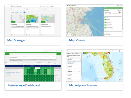 This GeoPlatform, which runs on AWS, provides an interface for the public and other government agencies to use geospatial data for their projects, such as building a map with data sources from several agencies to get a complete picture of an area, which is useful in disaster situations.
This platform is an example of how different parts of the government can share data and securely collaborate to solve mission objectives together in the cloud. In the past, agencies would often not let other agencies into their work areas, because it required a substantial lift for two agencies to work together, while still meeting security and compliance requirements. Often, that bar would be a deterrent for inter-agency collaboration on small projects. With agencies working in silos, there was a lot of duplication to reach the same result.
As the DOI looked at building the GeoPlatform, three mission requirements were non-negotiable: security, speed, and responsiveness.
With geoplatform.gov, the services used are already FedRAMP authorized and the hosting environment has a five-year FISMA Moderate ATO. Individual agencies do not need to worry about meeting compliance requirements on their own. GTRI uses Virtual Private Clouds (VPCs) along with AWS Quick Starts for NIST-based assurance frameworks.
“Transparency and automation allow us to have security and speed at scale. The NIST Quick Starts are an important part of our process, and it gives us consistency and documentation. This saves everyone a lot of time and money. The Quick Starts are a major resource that AWS provides to the community,” said Cameron Pope, Principal Cloud Architect, GTRI.
In addition to the security frameworks, GTRI uses AWS CloudTrail for audit logging, Amazon CloudWatch to understand how the environment is being used for application availability, performance, and security, and AWS CloudFormation for automation and security.
The data is stored and served in Amazon Simple Storage Service (Amazon S3) and Amazon Elastic Compute Cloud (Amazon EC2) servers. Additionally, the team uses Amazon Relational Database Service (Amazon RDS). “We are big fans of RDS. Not having to manage our SQL Server or Oracle databases allows us to focus more on the mission. It is an example of AWS doing the undifferentiated heavy lifting,” said Cameron.
With the AWS Cloud, agencies can analyze and share data with each other in an easy to consume, dynamic way, which was nearly impossible to do before the cloud.
“There is no way this could be built at the security level it was – as fast as it was – outside of the cloud. Not just because of the geospatial environment, but because more than nine bureaus are involved in this task order,” said Gail Springer, Director, Federal Programs and Capture Management, GTRI. “We were able to get to a production environment extremely quickly.”
In addition to the geoplatform.gov, GTRI is tasked with hosting and setting up geospatial data platforms, highly available and scalable environments for any government agency with geospatial data.
Join us for a unique Earth & Space on AWS experience Tuesday, June 19, 2018. Hear from customers and thought leaders who are unearthing discoveries through cloud technology and public-private partnerships. Choose from nine breakout sessions highlighting innovations with geospatial data, satellite technology, artificial intelligence, machine learning, high-performance computing, and much more. Register today.
