AWS Public Sector Blog
Tag: earth observation

Celebrating 40 years of space exploration
Space exploration has advanced significantly over the past 40 years. With missions like the space shuttle, NASA has led the way, demonstrating for the world their ability to push the boundaries of technological innovation to explore space, collect data, and enable scientific knowledge to make the world a better place. We are now in an exciting and daring new age as more organizations around the world are looking to explore space and achieve a sustainable operating presence. And fulfilling space-based missions demands innovation. Learn how AWS is supporting customers globally to push the boundaries of space exploration.

New re:Invent sessions for the public sector coming this month
AWS re:Invent 2020 is not over. Additional content will be released January 12-14, 2021 including more than 200 new no-cost, virtual sessions. In the public sector track, watch five new sessions this January on topics from preparing for ransomware to designing AI and ML applications. Hear from customers like the United States Census Bureau and Capella Space in sessions aired first in Americas, then in Asia-Pacific, and finally in EMEA – all available later on demand.
Capella uses space to bring you closer to Earth
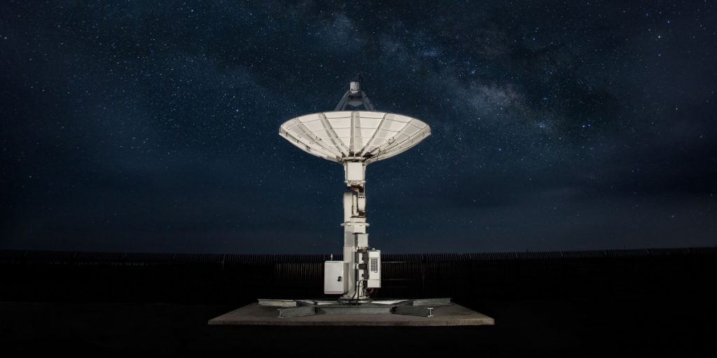
Capella Space, a provider of on-demand Earth observation data via synthetic aperture radar (SAR), is going all-in on AWS. Capella runs its entire IT infrastructure on AWS to automate and scale its operations. AWS Ground Station makes it simple and cost effective for Capella to command and control its constellation and receive its satellite data directly into AWS using a fully managed network of antenna systems located around the world.
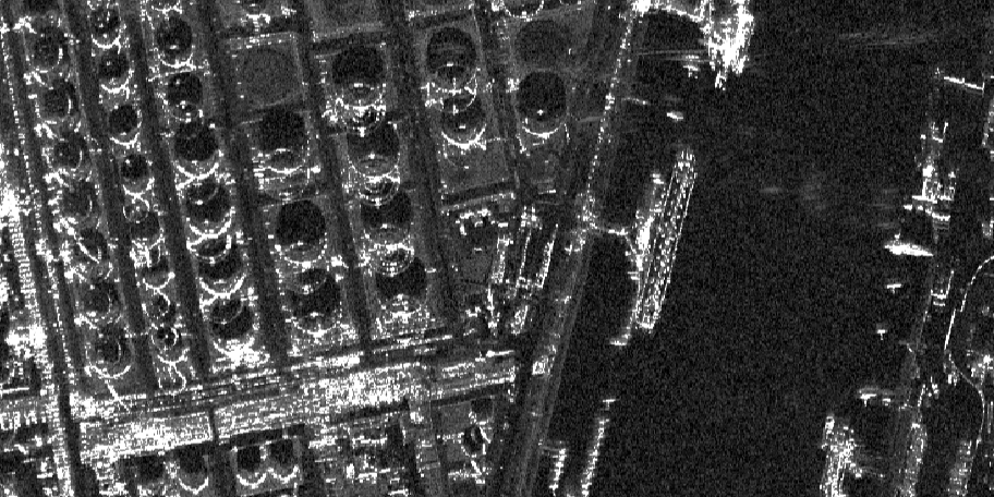
Capella and SpaceNet deliver unique views of Earth with machine learning on AWS
The breadth of challenges that can be addressed by overhead imagery is broad and continues to grow as new and improved sensors are deployed. To make the best use of this data, you need to have high-quality training data—data that you know is true (often called ground truth data) so that your algorithms can learn from it. A lack of this high-quality labeled training data continues to impede progress in many areas of remote sensing analytics, including machine learning. Two of the SpaceNet collaborators, Capella Space and AWS, are providing access to a unique dataset to help foster innovation in geospatial-based artificial intelligence. Learn more about Earth observation data, the SpaceNet 6 Challenge, and available datasets.

Mission: Exploring Earth to space
Far above the clouds, one of the fastest growing missions for the public sector is taking place. Technological advances and open data initiatives provide new paths to explore space, impacting our lives here on Earth. From satellites to rovers, cloud computing and cloud-enabled technologies help us find answers to our biggest questions.

In case you missed it: March 2020 top blog posts round up
In March 2020, the AWS Public Sector Blog covered stories on tools that support remote learning and teaching, cloud cost optimization, and achieving five nines in justice and public safety. Check out the top five blog posts of the month.

Earth observation using AWS Ground Station: A how to guide
Over the past decade, a crop of new companies focused on Earth observation (EO) have made valuable EO data more accessible to a broad audience than before. As a result, we are seeing a dramatic increase in EO science. The value of EO data is the ability to monitor change. Recently, new instrumentation aboard satellites such as radar now allow us to “see” through clouds, allowing observation of any part of the Earth. The reliable, repeatable, and accurate data now flowing from satellites is opening up the reality of operational services powered by satellite imagery. Learn how to get started with EO data using AWS Ground Station.

The true value of Earth Observation data…now
A picture of our entire Earth’s surface is taken every day. Such a possibility—or even the concept—would have seemed unfeasible and unaffordable just ten years ago. With continued technology improvements, we are witnessing a rapid increase in the number of miniature satellites capturing Earth observation (EO) data. This data is now accepted by many industries including agriculture, insurance, utilities, and urban planning to deliver actionable insights.

BlueDot Observatory – keeping an eye on our planet’s water resources
Managing water crises is one of the Sustainable Development Goals and the decline in the available quality and quantity of fresh water is ranked as one of the top ten most serious societal risks by the World Economic Forum’s 2018 Global Risks report. Using satellite imagery available through the AWS Open Data Program and the AWS Cloud, BlueDot Observatory is establishing a global monitoring system for all at-risk water bodies. This monitoring reveals a sad truth – the total loss of water bodies is in the not too distant future.
We invited Anze Zupanc, a data scientist who manages the BlueDot Observatory at Sinergise, to share how the AWS Open Data Program and the Amazon Sustainability Data Initiative support this work.

Apply for AWS credits to build Earth observation applications that support environmental and development goals
To help countries realize the potential of Earth observations for sustainable development, we are teaming with the Group on Earth Observations (GEO) to provide $1.5 million worth of cloud services for projects that improve understanding of our planet. Eligible government agencies and research institutions can apply for up to $100,000 of AWS Promotional Credits to build Earth observations applications that support environmental and development goals, including the Sendai Framework for Disaster Risk Reduction, the Paris Agreement and the United Nations Sustainable Development Goals.