AWS Public Sector Blog
Tag: satellites

Using customer-provided ephemerides with AWS Ground Station
Amazon Web Services (AWS) Ground Station is a cloud-based service that provides you with an opportunity to perform communication sessions with your satellite without spending a fortune on your own ground station infrastructure. AWS Ground Station balances between providing a ready-made solution and tailoring the service to meet the unique needs of each customer. One of the ways to customize the service is to use customer-provided ephemerides (CPE) for antenna targeting.

ASTERRA helps build a more sustainable Earth by identifying and mitigating ‘lost water’ using AWS
ASTERRA, an Israel-based geospatial and Earth observation company, uses Amazon Web Services (AWS) to help water utilities and a number of industries identify and mitigate pipeline leaks. ASTERRA uses AWS to derive intelligence and insights from beneath the surface of their largest installations and to bypass the need to break ground and dig for leaks. Read this post to learn how AWS has helped ASTERRA overcome traditional on-premises infrastructure limitations and to accelerate the development of solutions for anticipating and mitigating failures, saving water, energy, and avoiding carbon dioxide (CO2) emissions as a result.

Building high-throughput satellite data downlink architectures with AWS Ground Station WideBand DigIF and Amphinicy Blink SDR
This blog summarizes some of the benefits of cloud-based ground segment architectures, and demonstrates how users can build a proof-of-concept using AWS Ground Station’s capability to transport and deliver Wideband Digital Intermediate Frequency (DigIF) data, along with the software-defined radio Blink, built by the AWS Partner Amphinicy.

Japan Manned Space Systems uses AWS Snowcone to automate and optimize data delivery from space to Earth
Approximately 400 kilometers above the Earth’s surface, Japan Manned Space Systems Corporation (JAMSS) used an AWS Snowcone SSD onboard the International Space Station (ISS) to quickly and autonomously transmit large volumes of data from space back on the ground into AWS. The AWS Snowcone, which arrived on the ISS in July 2022 as part of the first Axiom Space Mission (Ax-1), is available to power on-orbit data processing experiments for researchers, students, and scientific organizations.

AWS successfully runs AWS compute and machine learning services on an orbiting satellite in a first-of-its kind space experiment
At re:Invent 2022, AWS announced that it successfully ran a suite of AWS compute and machine learning (ML) software on an orbiting satellite, in a first-of-its-kind space experiment. The experiment, conducted over the past 10 months in low Earth orbit (LEO), was designed to test a faster, more efficient method for customers to collect and analyze valuable space data directly on their orbiting satellites using the cloud.

Nara Space uses AWS to improve satellite image quality up to three times with deep learning
Nara Space Technology is a South Korea-based startup that builds nano satellite constellations and provides satellite data services to let customers quickly identify and address issues like changing climate conditions and disaster recovery to improve life on Earth. Nara Space provides solutions for nano satellite and small spacecraft system design, integration, development, and testing; enables satellite data analytics based on deep learning; and improves the visual quality of standard satellite imagery with its Super Resolution core technology. To do this, Nara Space uses AWS for secure, flexible, scalable, and cost-efficient cloud solutions.

How Satellogic and AWS are harnessing the power of space and cloud
Satellogic is a leader in high-resolution Earth observation (EO) data collection. The company is creating a live catalog of Earth and delivering daily updates to create a complete picture of changes to our planet for decision makers. Watch a new video to understand how Satellogic uses AWS Ground Station and the AWS Cloud to democratize access to EO data that’s being used for high-impact missions.

Virtualizing satellite communication operations with AWS
Virtualizing the satellite ground station with cloud technology can increase scalability, flexibility, and operational agility for satellite communications (satcom) operations. This blog post describes how AWS can help satcom customers virtualize their ground stations that are directly connected to satellite antenna systems. This post details the benefits of decoupling satellite ground station hardware and software components to improve scalability and flexibility. This post also presents a reference architecture to virtualize the satcom ground segment after the satellite signal is digitized at both ends of communication.

How African leaders use open data to fight deforestation and illegal mining
In Africa, scientific data is critical to helping the nation’s leaders tackle issues like water scarcity and climate change. A collaboration between nonprofit Digital Earth Africa (DE Africa) and the Amazon Sustainability Data Initiative (ASDI) is helping them access the data they need. DE Africa operates a free and user-friendly Earth observation (EO) data service that provides African policymakers with insights into a range of challenges, from natural resource management to the impacts of climate change. The service has already helped Ghanaian officials identify and tackle illegal mining, and provided decision-ready insights on flooding and drought in Tanzania and Nigeria.
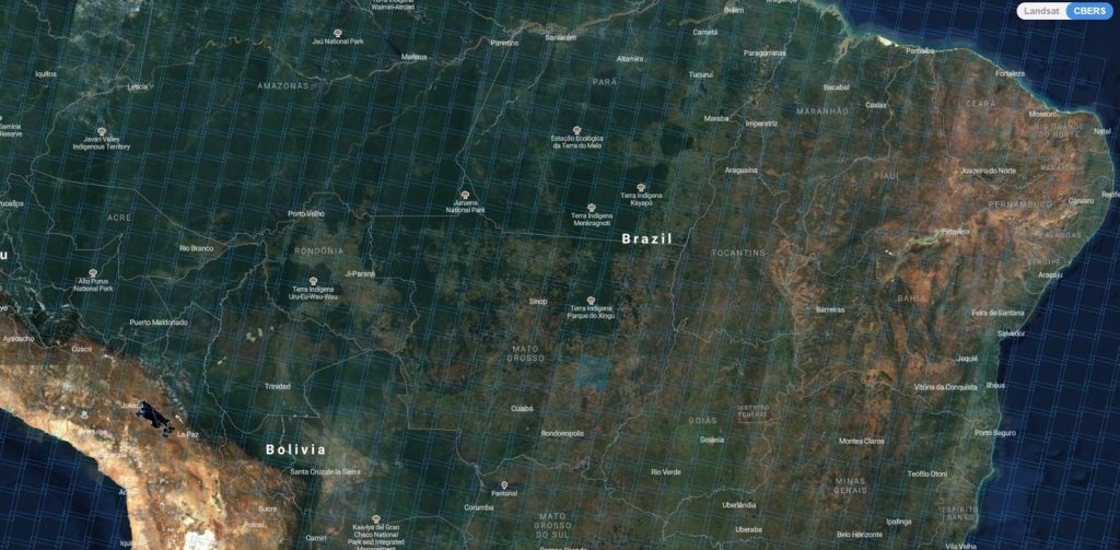
Keeping a SpatioTemporal Asset Catalog (STAC) Up To Date with SNS/SQS
The SpatioTemporal Asset Catalog (STAC) specification aims to standardize the way geospatial assets are exposed online and queried. The China-Brazil Earth Resources Satellites (CBERS) are the result of a cooperation agreement between Brazilian and Chinese space agencies (INPE and CAST, respectively), which started in 1988. Since then, five satellites were launched (CBERS-1/2/2A/3/4). The mission generates images from Earth with characteristics similar to USGS’ Landsat and ESA’s Sentinel-2 missions. In 2004, INPE announced that all CBERS-2 images would be available at no charge to the public. It was the first time this distribution model was used for medium-resolution satellite imagery. Now, this model is used for all CBERS satellite images.